 |
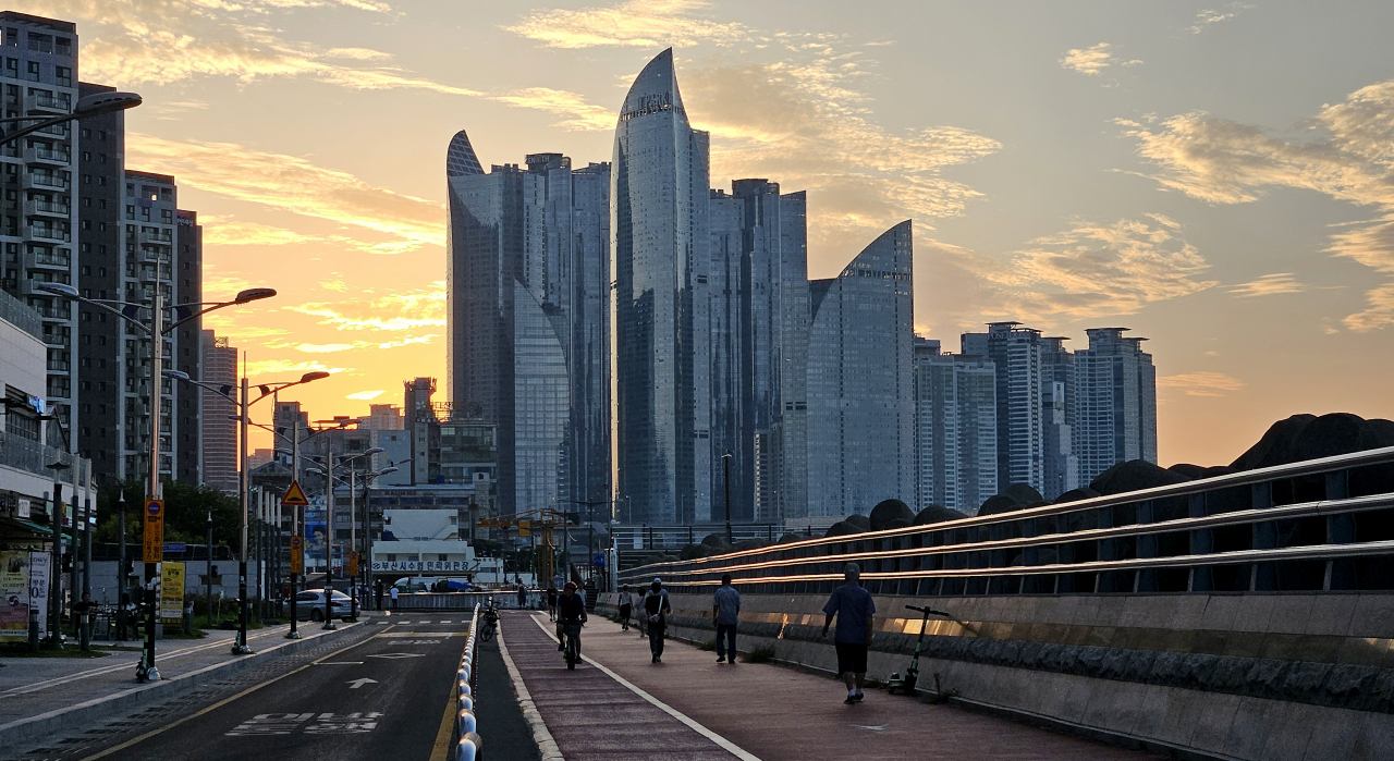
Pedestrians walk near Gwangalli Beach in Busan early Wednesday morning to escape the heat. As of Wednesday, Busan has seen tropical nights for 20 consecutive days. (Yonhap) |
While Japan is grappling with record rainfall from Typhoon Maria and bracing for three more typhoons, South Korea is experiencing the opposite -- intense heat, heat wave warnings and tropical nights.
In the past, after the roughly monthlong monsoon season in July, Korea would see heat waves last to mid-August, accompanied by typhoons and rain after, lowering overall temperatures to ease into fall.
However, instead of typhoon warnings and heavy rain this year, Korea has seen more heat wave warnings issued than normal this August.
Regarding the unexpected turn of weather events, Korea Meteorological Administration official Gong Sang-min confirmed to The Korea Herald that typhoons are currently unable to reach Korea due to the “continued convergence of the Tibetan and North Pacific high-pressure systems.”
“Currently, the two high-pressure systems are acting like a giant wall over the Korean Peninsula,” Gong said. “Due to the high-pressure systems covering Korea like a thick layer, cyclone clouds that would normally strike Korea are unable to come through.”
Toward the end of July, the convergence of Tibetan and North Pacific high-pressure systems triggered intense heat waves, high humidity levels and the tropical night phenomena in Korea, following the monsoon season.
Gong added that this is also the reason Japan has several typhoons predicted to strike the country soon, as typhoons that perhaps would have hit Korea were “pushed away” due to the high-pressure systems.
 |
Two children cool off at a fountain in Gwanghwamun Square in central Seoul on Tuesday evening. As of Wednesday, Seoul has seen tropical nights for 24 consecutive days. (Yonhap) |
However, while Korea remains out of the typhoons' path, the weather agency added that hot temperatures are likely to continue in the country due to hot easterly winds coming into Korea.
At the agency’s weather briefing to the press Wednesday, KMA official Kim Young-june stated that heat waves are likely to persist for some time due to strong sunlight and the hot easterly winds.
Though it is difficult to say exactly when the hot temperatures will cease, Kim added that nationwide heat waves and tropical nights are expected to continue at least until Aug. 24, with daytime temperatures on average reaching near or above 33 degrees Celsius.
The KMA also anticipates rain clouds to expand nationwide from Jeju Island on Aug. 20. However, this rain will not be effective in lowering overall temperatures in Korea, as it will be driven by hot and humid southerly winds. After the rain stops, the KMA anticipates the North Pacific anticyclone -- which covers Korea’s mid and lower atmospheres -- to expand and maintain hot temperatures in the country.
Meanwhile, on Wednesday record-breaking tropical nights were observed across the country -- referring to the phenomenon where the lowest temperature remains above 25 C after 6 p.m. the night before to 9 a.m. As of Wednesday, Seoul has seen tropical nights for 24 consecutive days, while Busan and Jeju Island have seen tropical nights for 20 consecutive days and 30 consecutive days, respectively.


![[Herald Interview] 'Trump will use tariffs as first line of defense for American manufacturing'](http://res.heraldm.com/phpwas/restmb_idxmake.php?idx=644&simg=/content/image/2024/11/26/20241126050017_0.jpg)

![[Health and care] Getting cancer young: Why cancer isn’t just an older person’s battle](http://res.heraldm.com/phpwas/restmb_idxmake.php?idx=644&simg=/content/image/2024/11/26/20241126050043_0.jpg)

![[Graphic News] International marriages on rise in Korea](http://res.heraldm.com/phpwas/restmb_idxmake.php?idx=644&simg=/content/image/2024/11/25/20241125050091_0.gif)