 |
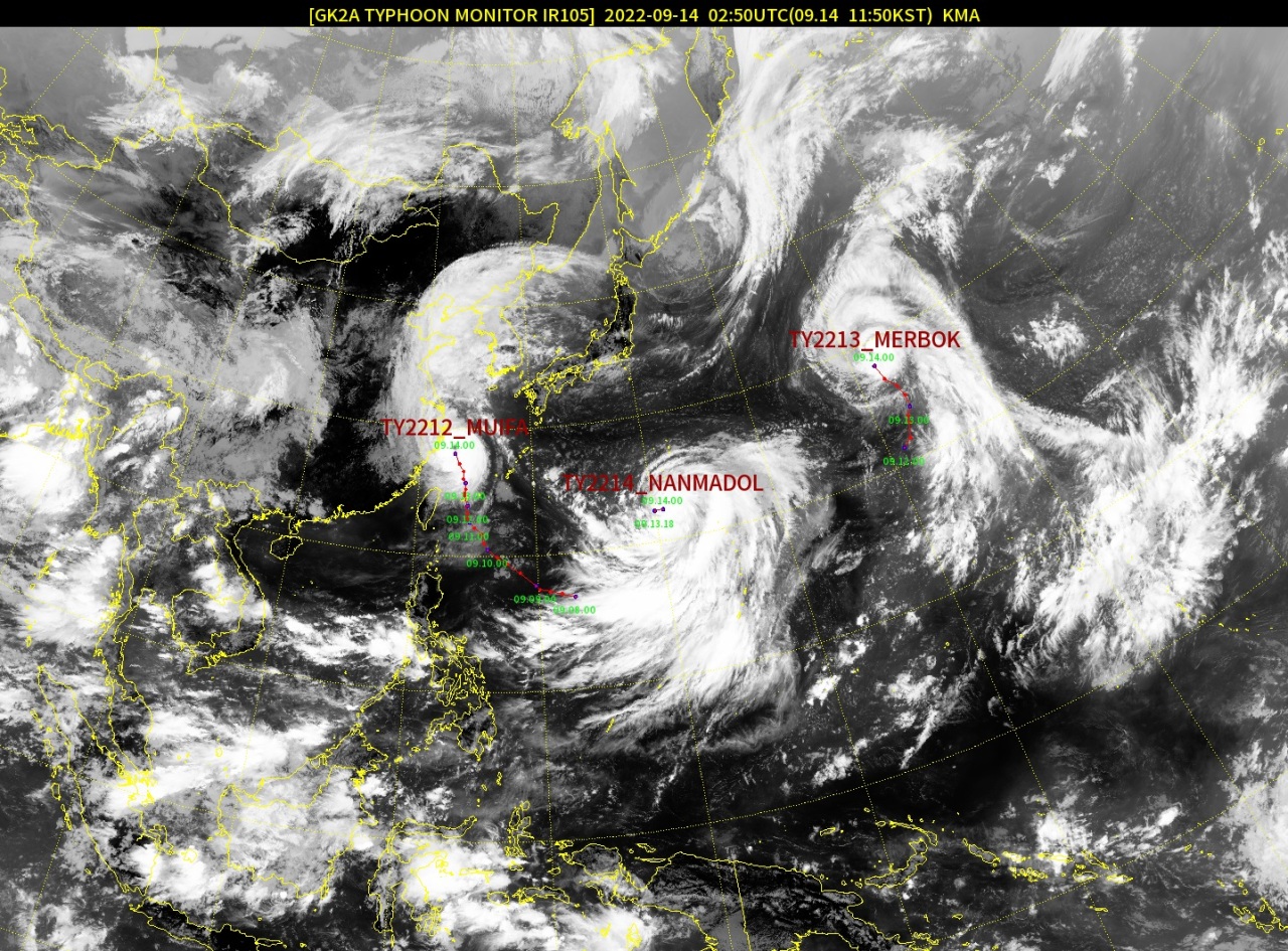
A satellite image shows newly developed Typhoon Nanmadol (center), Typhoon Muifa (left) and Typhoon Merbok (right), as of Wednesday morning. (KMA) |
The Korea Meteorological Administration said a tropical depression has developed into a typhoon over waters 1,370 kilometers east-southeast of Japan’s Okinawa as of 9 a.m. on Wednesday. The newly developed typhoon, the 14th typhoon this year, has been named Nanmadol.
Typhoon Nanmadol was less volatile, as of Wednesday, than Typhoon Hinnamnor by the time it had hit Korea last week.
Typhoon Nanmadol’s central pressure reached 994 hectopascals with a maximum wind speed of 21 meters per second, or 76 kilometers per hour.
Typhoon Nanmadol was to start moving north on Wednesday afternoon at a speed of 13 kph, according to the KMA. It could later pass Japan’s Okinawa to reach waters off Jeju Island -- 280 km south-southeast to the city of Seogwipo -- early Monday morning.
Typhoon Nanmadol’s track, however, could still change, and the KMA would have a clearer forecast as soon as Friday, an official said.
“The newly created typhoon will build up while being greatly influenced by surrounding air masses that can change the typhoon’s path,” the KMA official said.
Forecasts of the typhoon's projected path by other international weather agencies -- including the US Joint Typhoon Warning Center, the Japan Meteorological Agency and the European Centre for Medium-Range Weather Forecasts -- were similar to that of the KMA.
But, the ECMWF predicted that the typhoon will turn south and head toward Taiwan, the KMA said.
Meanwhile, South Korea will be safe from two other typhoons that have formed in the Northeast Asian region -- Typhoon Muifa and Typhoon Merbok -- the KMA noted.
Typhoon Muifa, the 12th typhoon this year, reached waters 420 km south-southeast of Shanghai, as of 9 a.m. Wednesday, with a central pressure reaching 965 hPa and winds reaching up to 37 mps. The forecaster predicted that the typhoon will continue to move north-northwest and become weaker as it travels inland.
Typhoon Merbok, the 13th typhoon, was at a considerable distance from the Korean Peninsula. The typhoon was moving over waters 2,260 km east-southeast of Tokyo, with a central pressure reaching 970 hPa and a maximum wind speed of 35 mps. Typhoon Merbok will continue to head north and weaken along the way, the KMA said.


![[Today’s K-pop] Blackpink’s Jennie, Lisa invited to Coachella as solo acts](http://res.heraldm.com/phpwas/restmb_idxmake.php?idx=644&simg=/content/image/2024/11/21/20241121050099_0.jpg)